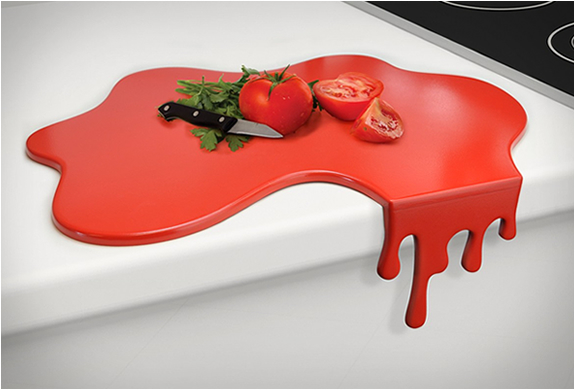
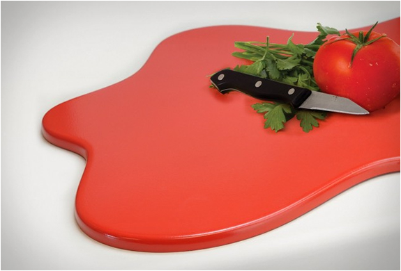
Splash Chopping Board
How cool is this chopping board? Designed by Mustard, a design studio that brings a fun perspective to everyday mundane products, the "Splash Chopping Board" is cleverly designed to make it stable against the edge of the kitchen counter using the drip as an edge. If necessary the "drips" can easily be removed, making a completely flat worktop saver. Available now for pre-order at online store mzube.
Also check out the very cool Paint Drip Table
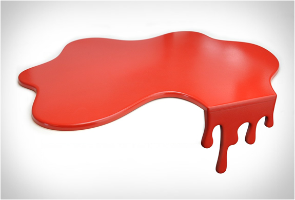
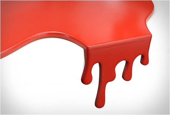
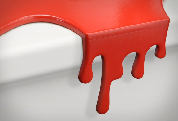
Also check out the very cool Paint Drip Table